Remote Sensing in Agriculture: Types, Uses, Benefits & Future

Abstract
Remote sensing has emerged as one of the most important technologies in modern agriculture. It enables the collection of information about crops, soil, water, and environmental conditions without direct physical contact with agricultural fields. Using satellites, drones, aircraft, and advanced sensors, remote sensing provides accurate and timely data that supports effective farm management and sustainable agricultural development. This article explains the concept of remote sensing, its types, technologies, applications, advantages, challenges, and future prospects in agriculture.
Introduction
Remote sensing is the science and technology of obtaining information about objects, areas, or phenomena from a distance without physical contact. It works by detecting and analyzing the electromagnetic radiation reflected or emitted from the Earth’s surface. The technology is widely used in environmental studies, meteorology, forestry, geology, urban planning, and especially agriculture.
In agriculture, remote sensing helps farmers monitor crop growth, evaluate soil conditions, detect pests and diseases, manage irrigation systems, and estimate crop production. Modern agricultural practices increasingly depend on remote sensing technologies because they improve productivity, reduce operational costs, conserve natural resources, and support precision farming.
The rapid development of satellite systems, unmanned aerial vehicles (UAVs), Geographic Information Systems (GIS), Artificial Intelligence (AI), and machine learning has significantly increased the importance of remote sensing in agricultural management.
Principles of Remote Sensing
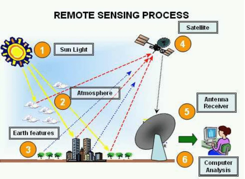
Remote sensing operates on the principle that all objects reflect or emit electromagnetic energy differently. Sensors mounted on satellites, drones, or aircraft capture this energy and convert it into useful information.
The remote sensing process generally involves the following steps:
Electromagnetic Spectrum in Remote Sensing
The electromagnetic spectrum consists of different wavelengths used in remote sensing applications.
Important Regions of the Electromagnetic Spectrum
|
Spectral Region |
Wavelength Range |
Agricultural Applications |
|---|---|---|
|
Visible Region |
0.4–0.7 µm |
Crop observation and vegetation analysis |
|
Near Infrared (NIR) |
0.7–1.3 µm |
Plant health and biomass monitoring |
|
Thermal Infrared |
3–14 µm |
Temperature and water stress analysis |
|
Microwave |
1 mm–1 m |
Soil moisture and radar applications |
Healthy vegetation reflects strongly in the near-infrared region while absorbing visible red light for photosynthesis. This property helps identify crop health conditions.
Types of Remote Sensing
1. Passive Remote Sensing
Passive remote sensing uses natural energy sources, mainly sunlight. Sensors record reflected solar radiation from the Earth’s surface.
Examples:
2. Active Remote Sensing
Active remote sensing systems emit their own energy and measure the reflected signal.
Examples:
Active systems can operate during night and cloudy weather conditions.
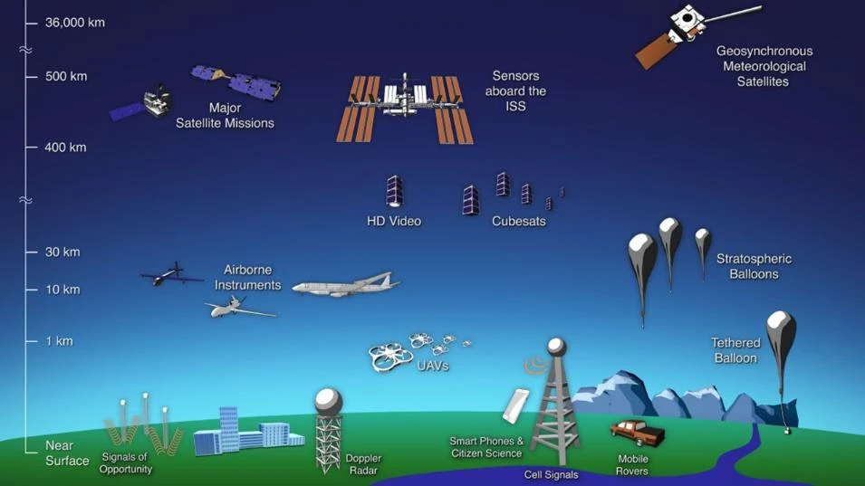
Platforms Used in Remote Sensing
Ground-Based Platforms
These include handheld devices and fixed monitoring stations used for field-level observations.
Airborne Platforms
Aircraft and drones are used to capture high-resolution aerial imagery for detailed agricultural analysis.
Spaceborne Platforms
Satellites provide large-scale and repeated observations of agricultural land over time.
Major Remote Sensing Technologies in Agriculture
1. Multispectral Imaging
Multispectral imaging captures data in different spectral bands. It is widely used to evaluate crop health, detect plant stress, and monitor vegetation growth.
Applications:
2. Thermal Imaging
Thermal sensors measure temperature variations in crops and soil.
Applications:
3. LiDAR (Light Detection and Ranging)
LiDAR technology uses laser beams to generate three-dimensional models of crop fields.
Applications:
4. Radar Remote Sensing
Radar systems use microwave signals that can penetrate clouds and vegetation.
Applications:
5. Satellite Imagery
Satellite imagery enables continuous monitoring of large agricultural areas.
Applications:
6. Aerial Imagery
Aerial images captured from aircraft or drones provide highly detailed information.
Applications:
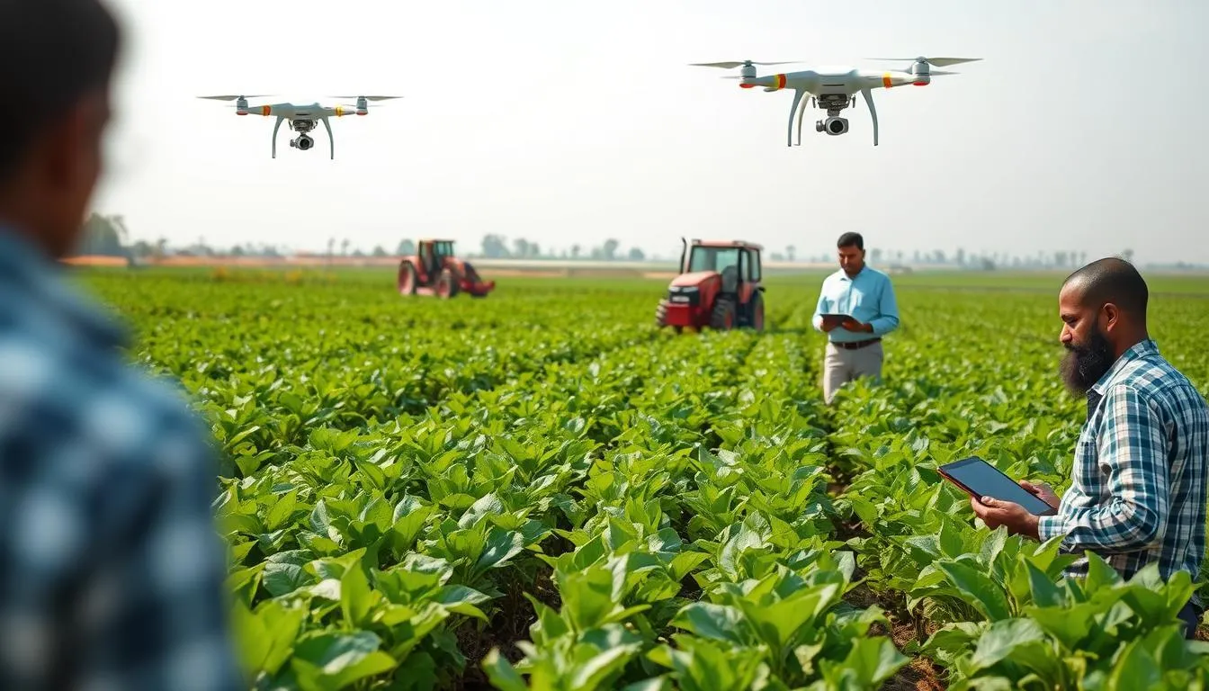
7. Unmanned Aerial Vehicles (UAVs)
UAVs or drones are increasingly used in modern agriculture because they provide rapid and accurate field-level data.
Applications:
Applications of Remote Sensing in Agriculture
1. Land Cover Mapping
Remote sensing helps identify different land cover types such as crops, forests, water bodies, and barren land. Farmers and planners use this information for crop planning and resource management.
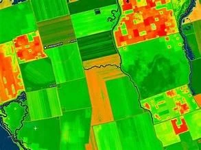
2. Precision Agriculture
Precision agriculture uses remote sensing and GIS technologies to manage crops according to field variability.
Benefits:
3. Irrigated Land Mapping
Satellite data helps monitor irrigated areas and evaluate water use efficiency.
Importance:
4. Crop Health Monitoring
Remote sensing can detect crop stress, diseases, and nutrient deficiencies at an early stage.
Indicators Used:
5. Yield Estimation
Remote sensing supports crop yield prediction by analyzing crop growth parameters.
Parameters Measured:
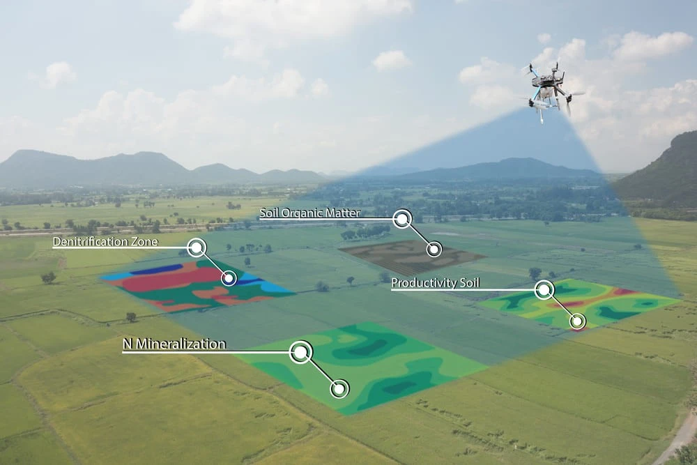
6. Soil Analysis
Remote sensing assists in soil mapping and assessment.
Applications:
7. Pest and Disease Detection
Early detection of pests and diseases helps reduce crop damage and production losses.
8. Climate Change Monitoring
Remote sensing helps monitor environmental changes affecting agriculture.
Examples:
9. Disaster Management
Remote sensing is useful for assessing agricultural damage caused by floods, storms, droughts, and fires.
Vegetation Indices in Agriculture
Vegetation indices are mathematical combinations of spectral bands used to assess crop conditions.
Normalized Difference Vegetation Index (NDVI)
NDVI is one of the most widely used vegetation indices.
Uses of NDVI:
Advantages of Remote Sensing in Agriculture
Remote sensing offers numerous benefits for modern farming systems:
Uses of NDVI:
Challenges and Limitations
Despite its advantages, remote sensing also faces several challenges.
Technical Challenges
Environmental Limitations
Economic Limitations
Future Prospects of Remote Sensing in Agriculture
The future of remote sensing in agriculture is highly promising. Emerging technologies such as Artificial Intelligence (AI), machine learning, cloud computing, and big data analytics are transforming agricultural monitoring systems.
Future Developments
Integration of remote sensing with GIS and Internet of Things (IoT) technologies will further improve agricultural efficiency and sustainability.
Conclusion:
Remote sensing has revolutionized modern agriculture by providing accurate, timely, and reliable information about crops, soil, water, and environmental conditions. The technology supports precision farming, improves productivity, reduces resource wastage, and enhances sustainable agricultural development.
Through the use of satellites, drones, thermal sensors, radar systems, and advanced data analysis techniques, farmers can make better management decisions and respond quickly to agricultural challenges. Although remote sensing has some limitations such as high costs and data complexity, continuous technological advancements are making it more accessible and effective.
In the future, the integration of remote sensing with Artificial Intelligence, machine learning, GIS, and smart farming technologies will play a major role in ensuring global food security and sustainable agricultural practices.